Workshops on Land Use and Land Cover Mapping Held
October 23, 2019
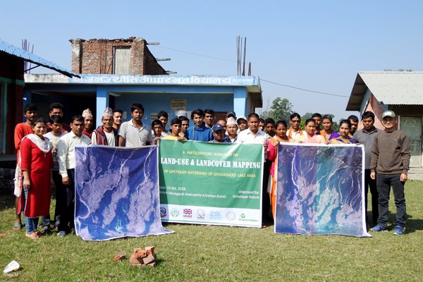
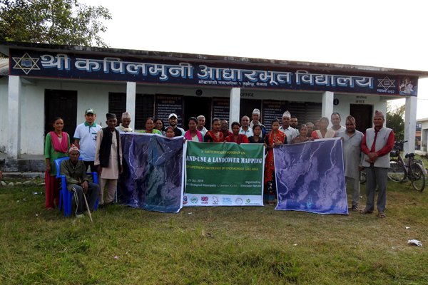
Workshops on Land Use and Land Cover Mapping were held on 23 October 2019. First workshop was organized at Janajyoti Basic School situated at Ghodaghodi Municipality-4, Simthari from 8 AM till 12 PM. The workshop was attended by 32 local people from Simthari, Kauwapari and Bardahuwa. Second workshop was conducted at Kapilmuni Basic School of Ghodaghodi Municipality-1, Laxmipur from 1 PM till 5 PM. There were a total of 31 participants from Belar, Loharpur, Sirjana shivir, Paari Belar, Nakrodi tole and Laxmipur.
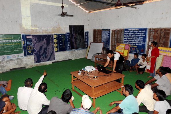
Both the workshops were organized informally that started with welcome remarks from HN's Community Officer Ms. Bishna Chaudhary, followed by a short introductory session. In this session, the participants introduced themselves with their name address, profession and the field/organization they represent which helped us to know how diverse the participants are. HN's Research Officer Mr. Kul Bahdur Thapa briefed on the project background and objectives of the workshop. Our GIS Expert Mr. Hari Basnet facilitated the inputs collection session by showing Google Earth map of GLA. The session was very interactive where almost all participants got involved in the discussion and shared their observations.
After concluding the workshops, GIS Expert Mr. Hari Basnet, HN's Research Officer Mr. Kul Bahadur Thapa, Community Officer Ms. Bishna Chaudhary, CGLTDB's Vice President Mr. Daya Ram Chaudhary, and Social Mobilizer Ms. Manisha Chaudhary gathered at CGLTDB's office at Sukhad and discussed on inputs received from community people. We obtained more information from MR. DR Chaudhary and also talked on CGLTDB's draft of Master Plan.
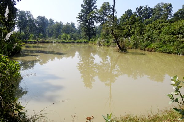
On 24 October 2019, our GIS Expert and HN's team carried out the field visit in GLA, The visit was divided into two shifts. First shift was before lunch (8 AM to 12 PM) in the eastern part of the GLA, starting from Sukhad up to Lathuwa where we observed, forests, small patches of grassland, lakes like Chandrabijuwa, Baisahawa, Nakrod, Samrahuwa Chatiya, Budhiya Nakrod, Ramphal, Khaurahi Chatiya, legal and illegal settlements, agricultural lands, recently encroached area, streams, canals, roads, and a water hole constructed by Lathuwa CFUG to provide water for wildlife. Second shift was after lunch (1 PM to 5 PM) in the western part of the GLA, starting from Simthari up to Gairakhera where we observed, Tendi and Perseni Lakes, settlements, agricultural lands, Kauwa khola, newly settled Batulichaur Village, and Sita Kund.